On August 31, an alarm signal was beaten regarding a fire in the Amulsar area on Facebook by Jermuk resident Shirak Buniatyan. On September 1, the Inspection Body for Environmental Protection and Mining issued a clarification, stating that the fire did not occur in the Amulsar-adjacent area but rather in the Saravan settlement of the Vayk community.
According to the Inspection Body’s statement, administrative proceedings were initiated on August 31 at around 15:30 concerning a fire that broke out in the Ughadzor highland area of Vayots Dzor Region. “Preliminary information indicates that in the Saravan settlement of the Vayk community (not included in the Amulsar area), the fire was caused by welding works on high-voltage transmission line poles. Approximately 45 hectares of shrubs, various types of trees, and dry grassland have burned. An assessment of the environmental damage caused will be carried out,” the statement said.
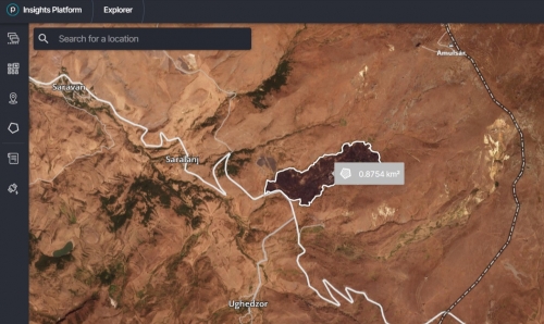
It should be noted that the Hetq information platform conducted a fact-checking study in connection with the alert. According to Hetq, on September 1 at 12:18 Yerevan time, the American company Planet Labs’ Super Dove satellites photographed the area several times. “The images show that the fire did not break out near Saravan, which is relatively far from Amulsar, but rather in the area between the Saralanj and Ughadzor settlements—on the southwestern slope of Amulsar, right next to the Yerevan–Meghri highway. Measurements taken from the satellite images show not 45 hectares, but nearly double—0.875 sq. km, equal to 87.5 hectares,” the Hetq report stated.
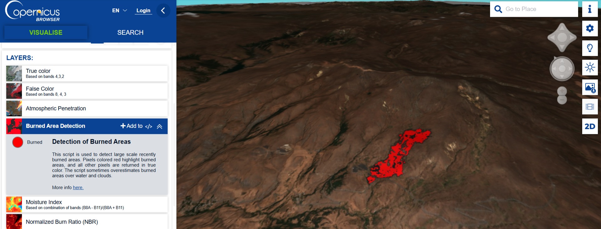
The same source also published a 3D model based on images from the European Sentinel-2 satellite, which likewise confirmed that on August 31, the fire broke out near the Yerevan–Meghri (M-2) highway and spread along the southwestern slope of Amulsar.
September 03, 2025 at 16:29