
EcoLur
In the framework of the project entitled “Support to SHPP-relating Reforms Through the Dialogue of Public and RA Nature Protection Ministry for Sustainable Use of River Ecosystems” the expert group visited “Meghri” SHPP. “Meghri” SHPP is located in Syunik Region. The SHPP is constructed on the Meghri River (length – 36 km). “Meghri” SHPP is located in the buffer zone of “Arevik” National Park. It’s operated by “QH” LLC.
As a result of the monitoring, the expert group found out:
- The SHPP has been operating since 1936.
- Station type is estimated one.
- According to the company, the static pressure of the SHPP is 50 m, according to the certificate issued by the Public Services Regulatory Committee on 1 January 2016, the estimated pressure of the SHPP is 51 m. According to the project and the PSRC certificate, the estimated yield used by the SHPP is 2.2 m3/s. According to the PSRC certificate, the projected capacity is 840 kW. According to the PSRC, as of 01.01.2016 the factual useful delivery of the electricity is 2.189 million kWh, duration of license - 25.06.1999- 25.06.2029, water usage permit - 01.12.2011-01.12.2014.
- The difference between the coordinates laid down in the water usage permit and the real coordinates is insignificant, but the incompliance between the heights among sea level is huge.
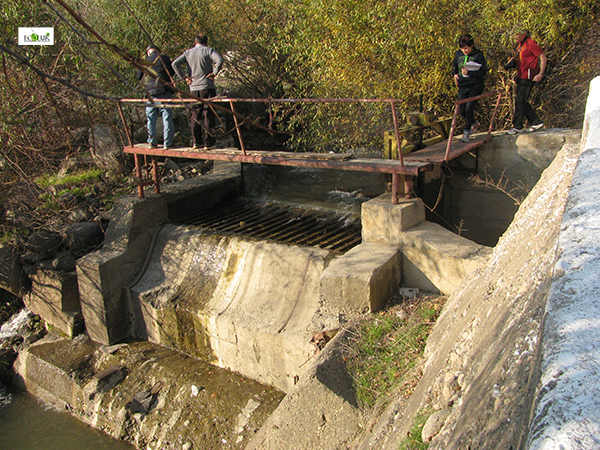
- The length of the concrete dam of the SHPP is 6 m, its height is 2.5 m.
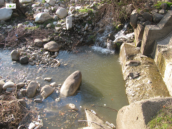
- The hole opened through the concrete dam constructed on the riverbed serves as a fish passway in the head section of the SHPP, from where the river water flows like a tributary for around 10 meters and then joins the riverbed below the dam. Such a structure resembles a natural chute, which is easily overcome by the brown trout, Kura barbell, but there may be certain difficulties for the South Caucasus Sprilin.
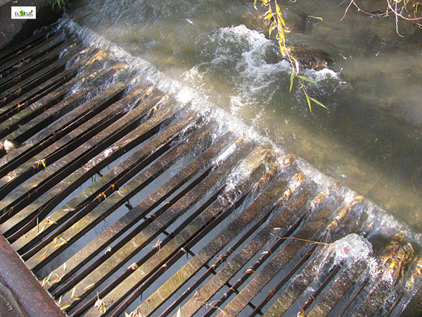
- There is a horizontal garbage-collecting cage net of about 4.5 meters long, and the distance between its bars is 5-15 cm. The distance between bars can’t be an obstacle for the fish living in the river to appear in the pressure pipeline.
- You can meet the following fish species in the section of the Meghri River, where the SHPP head section is constructed – brown trout, Kura barbell and South Caucasus Sprilin.
- The water is transferred to the station through the canals and two tunnels (650 and 200 m long), and then through parallel 2 pipes – 135 m long and 0.66 m diameter.
- The aggregate percentage correlation of the SHPP derivation of Meghri SHPP (the length of the pipeline is 135 m, according to the PSRC) and Nzhdeh SHPP (the length of the pipeline is 2020, according to the project) makes up 5.98% with the river length.
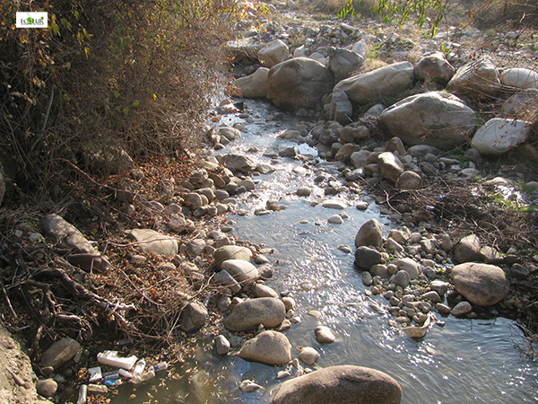
- According to the water usage permit, water intake of 24000.0 cum water may be implemented in 12 months ensuring an environmental flow of 028 cum/s in the Meghri River.
- The automated management and recording of the environmental flow is not ensured.
- The riverbed is divided into two parts, the flows of the water intake and environmental flow are regulated through the concrete wall and the hole opened in it.
- There is no water-meter sealed by a relevant environmental body in the water intake.
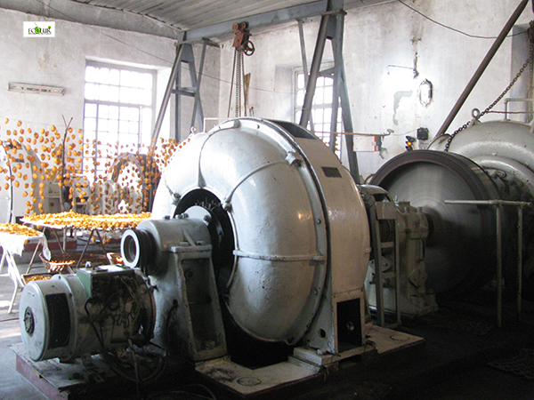
- There are two hydroaggregates of Russian production installed in the SHPP building, which are old and have low technical efficiency. At the moment of observation only one aggregate was operating, which ensured 100 kW capacity with 100 l water amount.
- There is semi-automated management system operating in the station.
- The transformer substation is fenced.
- According to “Computation Center” CJSC data, in 2014 “Meghri” SHPP operated for 10 months and produced 2406592 kW electricity.
- The station area is improved, but not greened.
Proposals
- To ensure automatic management of environmental flow in the head section, installation of water-measuring devices and online control.
- To re-equip the SHPP with new and up-to-date hydroaggregates having high efficiency to have entirely automated management system, to operate with little water amount and to ensure the projected capacity.
- To correct absolute heights of water intake and water discharge points above sea level in all documents.
 |
 |
 |
 |
 |
 |
 |
 |
 |
The material was developed in the frames of “Supporting reforms in the sector of small hydro power plants through enabling a dialogue between civil society and the Ministry of Nature Protection for sustainable use of river ecosystems” supported by UNDP/GEF Small Grants Programme".
April 27, 2016 at 14:26