EcoLur
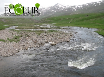
The Gizhget River flows in Syunik Region, it’s the right tributary to Sisian, while the latter is one of the tributaries to the Vorotan River. The Gizhget River starts from the central part of Zangezour mountains and joins the river near Arevis River. Its lenght is 8.5 km.
“Arevis-1” SHPP is being constructed on this river, under the project its derivation length will be 2478 meters. Thus, the SHPP will pipe a total river area of 2478 meters, which will make up 29․1529412% of the river.
Under EcoLur’s Ecological Risk Model, it will cause critical situation for the river.
This material was made possible through the full support of Open Society Foundations – Armenia’s Policy Fellowship Program Initiative, grant number 18571. Ideas, thoughts, and arguments presented in the paper are the sole expression of the author’s views and do not reflect those of Open Society Assistance Foundations – Armenia.
April 11, 2014 at 11:31