EcoLur
On July 2, 2015 the RA Government adopted 731-N decision according to which the area of "Zangezour" Biosphere Complex was factually reduced by 630.6541 ha at the expense of "Arevik" National Park and "Zangezour" State Preserve. Reminder: that complex was established by the 1465-N decision adopted by the RA Government on December 19, 2013 by which "Shikahogh" state preserve, "Arevik" National Park,"Plane-tree grove","Zangezour", "Khoustoup","Boghakar" and "Sev Litch" state preserves were united.
By the 731-N decision a change was made in N 1187-N decision adopted on October 15, 2009, in N 1465-N decision adopted on 19 December, 2013, in N 1209-N decision adopted on 15 October, 2009 by the RA Government.
The decision is based on the specification of boundaries of "Arevik" National Park and "Zangezour" state preserve, which in 2013 lost their legal status and changed into specially protected areas of nature as a result of establishing"Zangezour" Biosphere Complex. The status and boundaries of "Arevik" National Park and "Zangezour" state preserve were defined by N 1209-N decision adopted on 15 October, 2009 and N 1187-N decision adopted on 15 October, 2009 by the RA Government.
If we compare the new and old areas of "Arevik" National Park the area has been reduced by 471.61 ha according to the present decision of the Government. If in 2009 by the decision on establishing "Arevik" National Park the area of the park made up 34410.80 ha as a result of changes it will make up 33939.19 ha. The area of "Zangezour" state preserve was reduced by159.0441 ha. Instead of 25870.64 ha it constitutes 25711.5959 ha by the new decision.
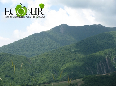
"Arevik" National Park was established on the south slope of Meghri mountain of Zangezour mountain range in Syunik Province (Meghri region) in the watersheds of Shvanidzor and Nyuvard Rivers on the bases of Meghri forestry and "Boghakar" preserve. It includes the upper and middle parts of the watershed of Meghri River stretching from Tashtoun village up to beyond the administrative borders of the rural communities of Vahramavar, up to the state-owned lands situated on the eastern slopes of Zangezour mountain range constituting 34401.8 ha of total surface.
"Zangezour" state preserve includes the upper part of the river basin of Voghji River of Zangezour mountain range and the gulch areas of Bargushat mountain range near the banks of its left bank Geghi stream beyond the administrative borders of the communities of Kapan region in Syunik Province.
During the last 4 years "Arevik" National Park was subjected to the invasion of mining companies. Only in Tashtoun community "Stortrans" company received a permission to do geological and exploration works, and the Armenian-Russian "At Metals" company has already all the authorizing documents for the exploitation of Meghrasar gold mine which might contain uranium according to the data of uranium scientific campaign performed in the Soviet times. The area of Lehvaz community is also used for mining works.
And in "Zangezour" state preserve building of Small HPPs is in an active process. "Sun and Water" LTD plans to build "Kaputjugh" and "Kajarants" SHPPs in the area of the preserve.
We don't exclude that the real reason of "Zangezour" Biosphere Complex reduction is the pressure by businnes and lobbysts connected with it in the Government.
July 15, 2015 at 15:04