

EcoLur
The shadow gardens in Armenia will be detected through the analysis of satellite images, as Acting Deputy PM Tigran Avinyan posted on his FB page. He wrote, 'One of the obstacles for the fair distribution of the irrigation water is 'shadow gardens', which factually use water, but they are no concluded contracts, and, consequently, no paid legal fees. I am presenting a part of the map of factually irrigated land areas, which has been available due to the analysis of satellite images. This is a result of the cooperation between my office and a private researcher. The blue highlights are those land areas, which are factually irrigated and the sections in black are those land areas, which have contracts signed with the water using companies.
As a result of this work, 'shadow parks' will be revealed and will have proper registration, which will result in having the real image of irrigated land areas.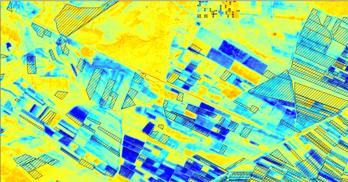
October 31, 2018 at 19:22